Click to navigate to each category:


ARCHAEOBOTANY
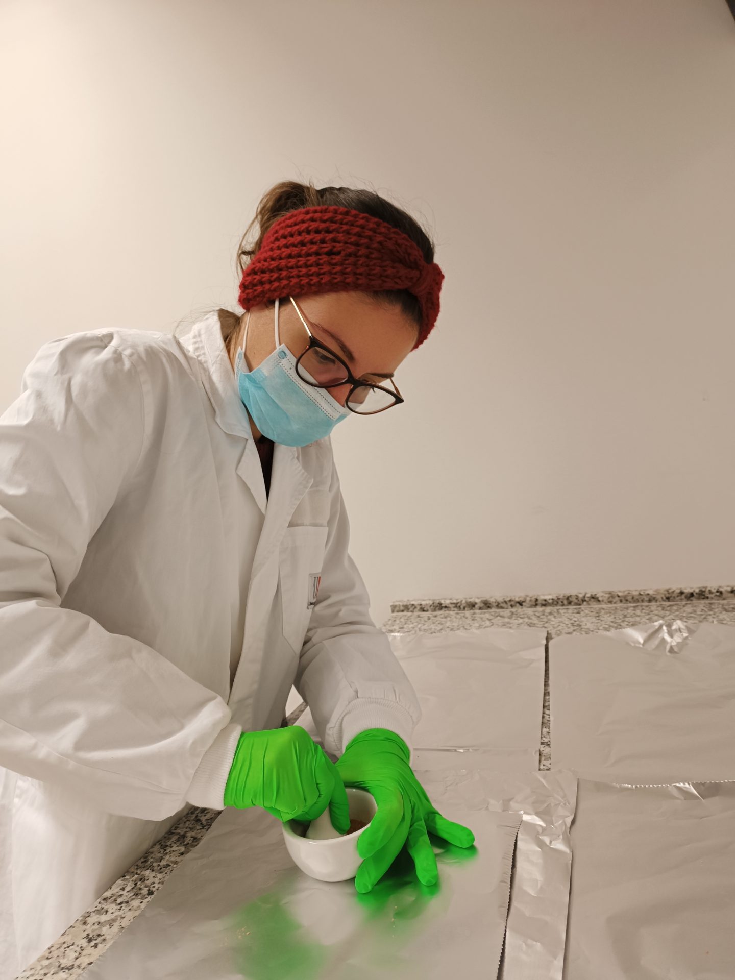
The Archaeobotany team, led by Dr Alexandra Livarda, explores human-plant-environment interactions in Europe and beyond. Our work aims to elucidate social relations, identities, ideologies, land management, economy, and trade in the past, demonstrating the crucial role of plants in shaping human history.
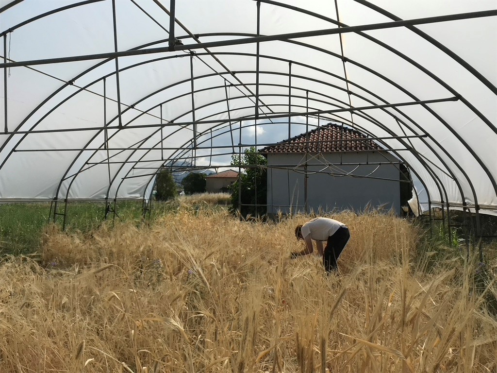
Our main research focus is on foodways, which provides a unique lens into past decision-making processes and their social impact, and on the development of novel methodological tools for the analyses of archaeobotanical remains but also for their use as proxies to investigate key archaeological questions (such as trade and the development of urbanisation). Our projects extend from the Neolithic to the medieval period, with a particular emphasis on the Late Bronze and Iron Age, as well as the Roman period.
Our multidisciplinary approach combines macrofossil analysis (seeds and other macroscopic plant parts, wood and charcoal) with experimental studies, agronomy, 3D Geometric Modern Morphometrics, statistics, and geochemical (e.g. stable isotopes), organic residue and various computational analyses. We work closely with the computational archaeology team of GIAP (ICAC) and the Institute of Plant Breeding and Genetic Resources (IPGRB) in Greece, the national body responsible for agricultural research and technology, to create cutting-edge methodologies. These do not only contribute to the development of the archaeobotanical discipline and allow, thus, more in-depth readings of past societies, but also support modern plant biodiversity, food security and sustainability.
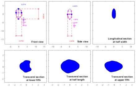
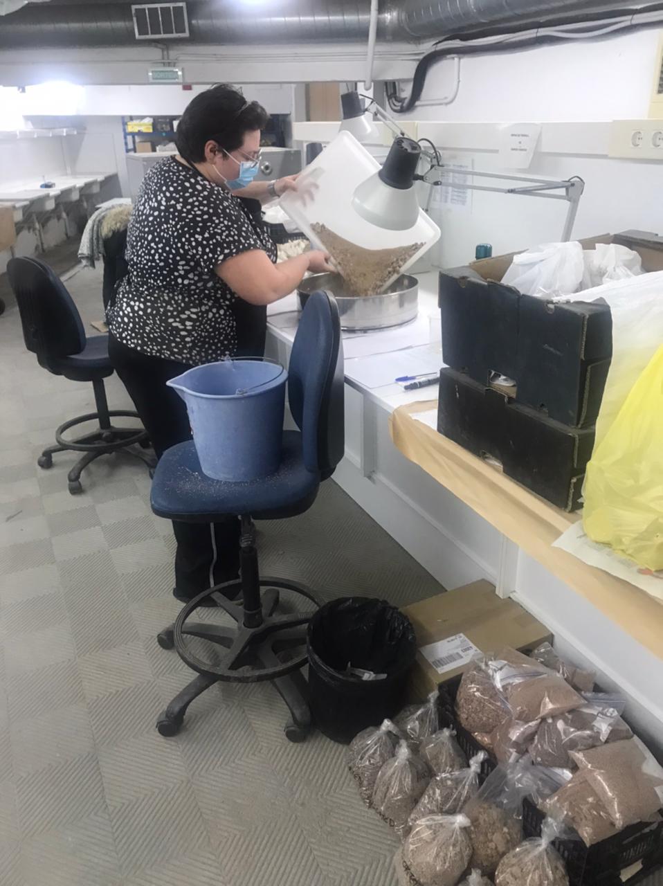
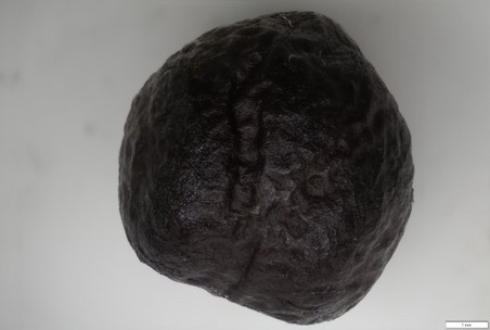
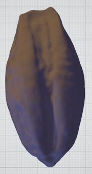
We have pioneered the development of a new, non-destructive, methodology that allows the investigation of agriculture in the past through the examination of the 3D shape of barley grains – one of the most common plant taxa recovered in archaeological sites in Europe and western Asia.
Follow the latest news of the archaeobotany team.
ARCHAEOZOOLOGY
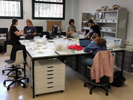
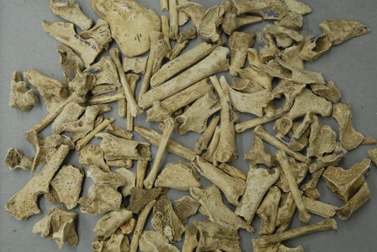
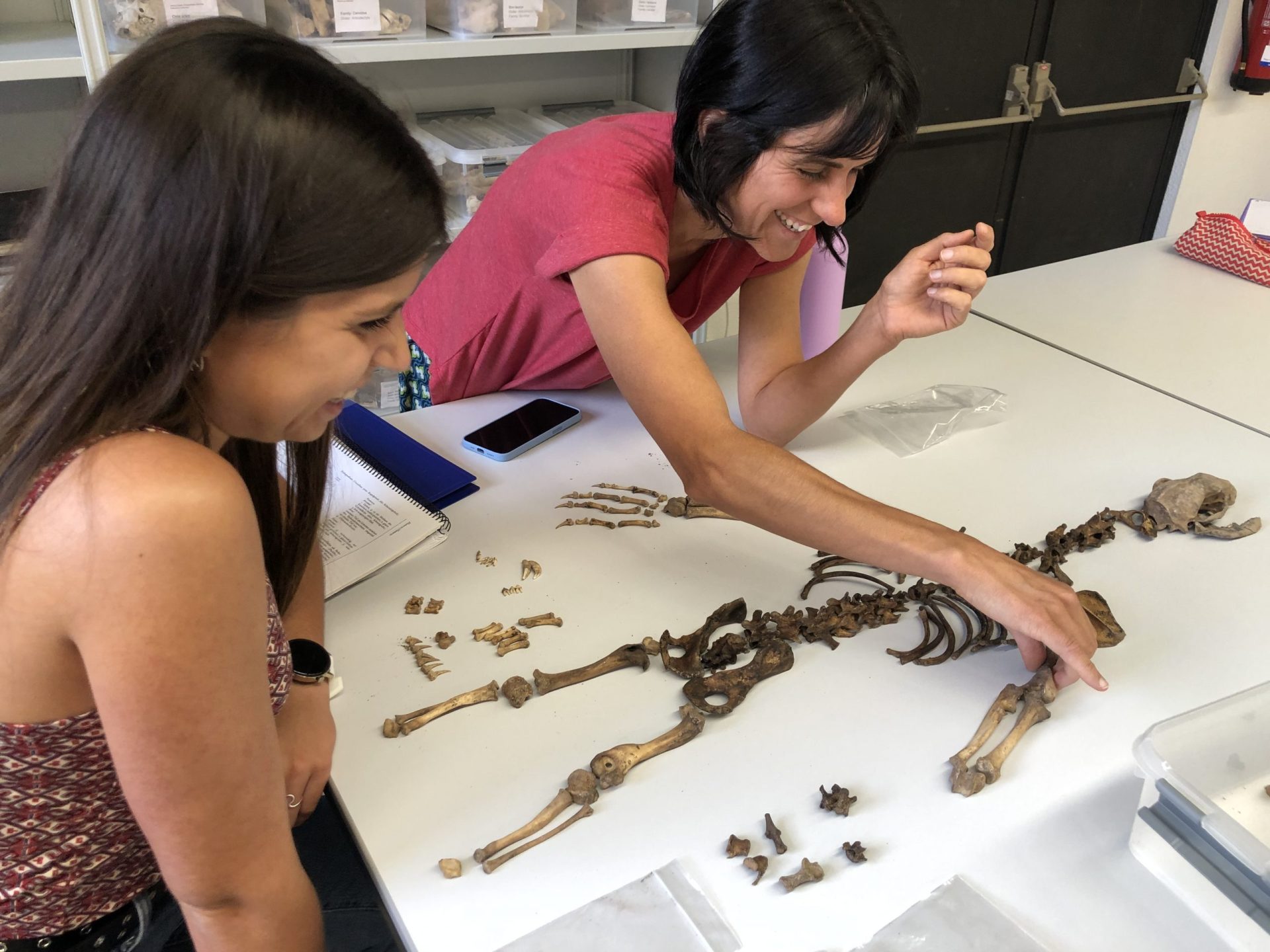
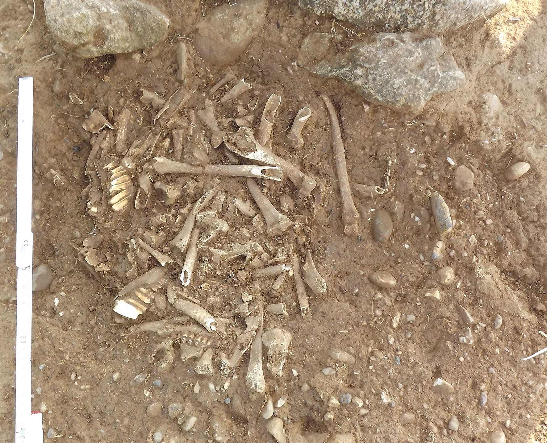
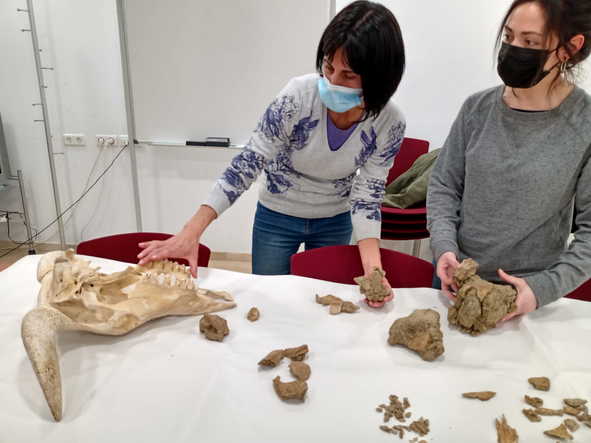
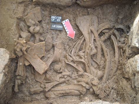
The Archaeozoology team, led by Dr Lídia Colominas, examines the interactions between animals and societies of the past, utilising faunal remains (bones, horns, shells and teeth) found during excavations as primary data. Our research lines are focused on animal husbandry, trade, human diet, and ritual practices, providing valuable insights into social identity, cultural choices, inequalities, ideology, and economic changes.
The team is currently studying societies from the 5th century BC to the 9th century AD in the Western Mediterranean (Catalonia and Tunisia) and the Eastern Mediterranean (Israel), with a particular interest in Roman societies.
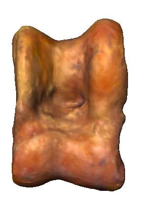
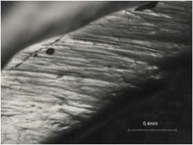
We continuously integrate innovative methodological approaches to complement our standard osteological analyses. We employ palaeogenetic analysis to study animal introductions into newly territories. Currently, we utilize microwear analyses to explore animal diets and understand animal management and land use, and Geometric Morphometric methods to study animal mobility and phenotipic changes. These new approaches enable us to gain a more comprehensive understanding of the human-animal relationships in the past.
Archaeozoological research not only contributes to the understanding of past societies but also holds relevance to modern-day issues. For instance, our research can inform sustainable practices for the present and future in relation to animal husbandry, biodiversity preservation and reintroduction and protection of endangered species. By investigating the interactions between animals and societies in the past, we aim to provide a deeper understanding of our shared history and its impact on our present world.
Follow all the news of the archaeozoology team.
COMPUTATIONAL ARCHAEOLOGY
The Computational Archaeology team, led by Prof Hèctor A. Orengo, employs a range of cutting-edge techniques to detect, identify, map, quantify, and analyse archaeological features of interest.
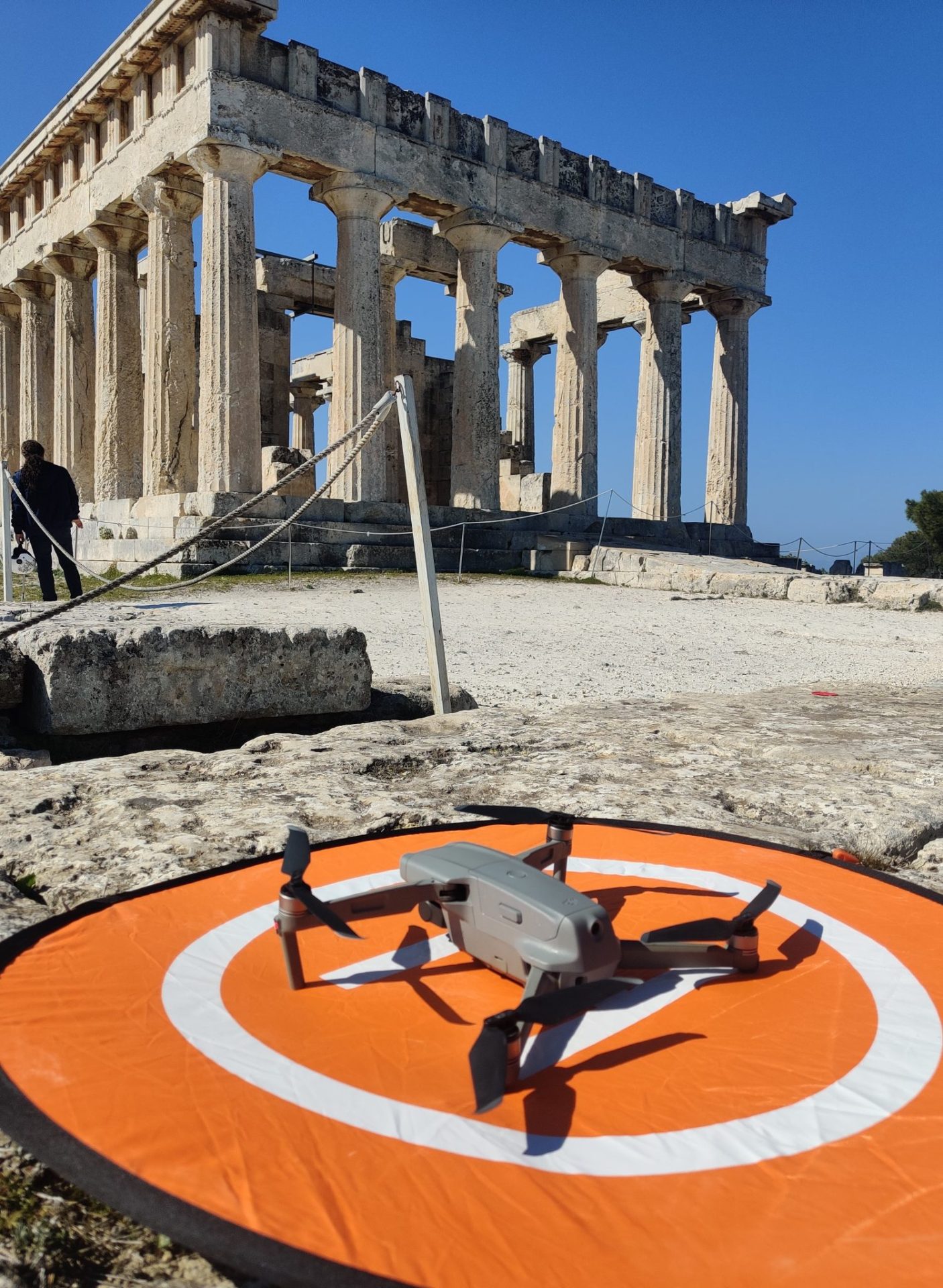
The team’s expertise in remote sensing extends to the processing, analysis, and interpretation of various remote sensing datasets, including historical imagery, multispectral and hyperspectral satelliteimagery, synthetic aperture radar, digital elevation models, LiDAR data, and UAV-based RGB and thermal images.
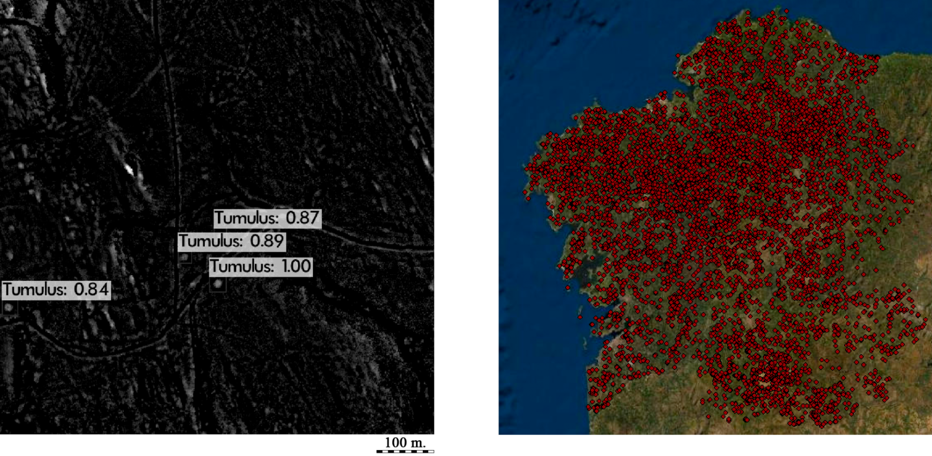
We focus our remote-based research on the development of multisource, multitemporal analytical methods that employ Big Data in several types of computing platforms, and the accurate detection of archaeological sites, features, and objects in all types of geospatial imagery using machine and deep learning models.
Spatial analysis is fundamental in archaeological research, as all human actions and interactions develop in a physical space with a spatial dimension that can be measured and analysed. We have a strong expertise in the use of Geographic Information Systems (GIS) and employ multiple techniques with a spatial component, such as geostatistics, dataset correlation and data fusion, classification, data visualization, DTM development, and topographic analysis. We also routinely employ other computational approaches for the study of past human environment interactions such as least-cost route analysis, predictive modeling, visibility analysis, spatial network analysis, spatial syntax analysis, water flow analysis, 3D reconstruction, shape analysis and 3D data correlation, and time-aware and multitemporal analysis.
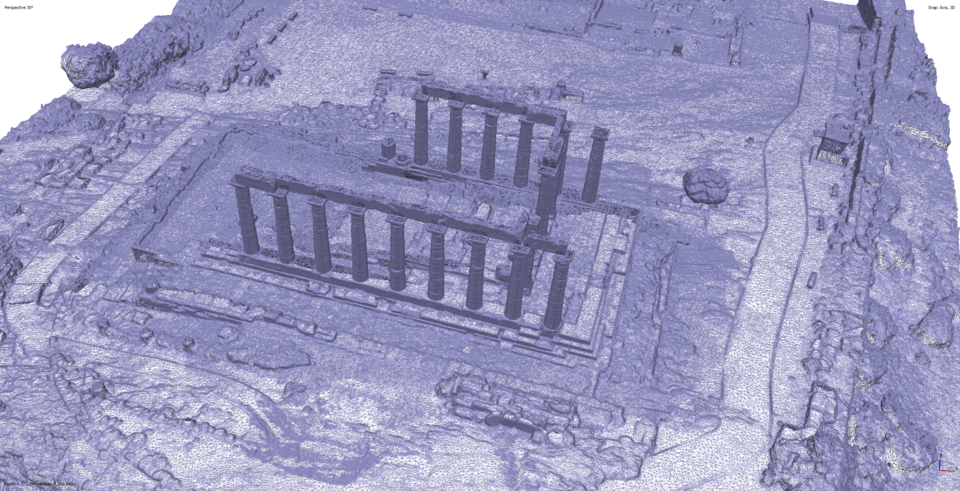
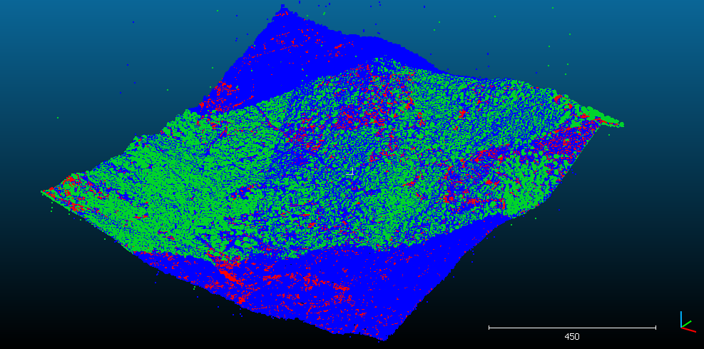
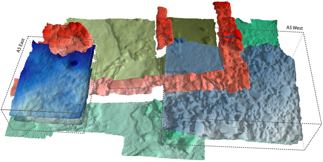
GIAP’s experience in 3D reconstructions ranges from lidar for the analysis of large areas to photogrammetry and laser scanning for the reconstruction of landscapes, buildings, the excavation process, and even centrimetric items and ecofacts. We pioneered some of the earliest applications ofvolumetric recording of excavations, the use of historical aerial photography for the reconstruction of ‘lost’ landscapes and the extraction of microreliefs from drone-based photogrammetry.
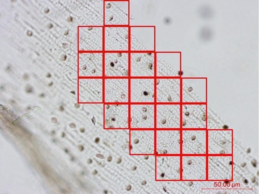
We are currently experimenting with sub-centrimetric 3D reconstructions, from which we extract purposely developed 3D measurements that can be analyzed using geometric morphometrics and artificial intelligence. These methods allow us to extract sociocultural readings from some of the smallest items recovered in archaeological excavations.

Follow all the news of the Computational Archaeology team
CULTURAL LANDSCAPES ARCHAEOLOGY AND PALAEOENVIRONMENT
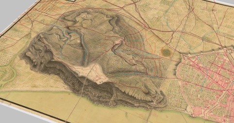
The Cultural Landscapes Archaeology and Palaeoenvironment team, led by Dr Josep Maria Palet, focuses on identifying the cultural factors that give landscapes their value and understanding the historical human-environmental relationships that have shaped them. This enables us to describe the long-term values and socioeconomic conditions that have contributed to today’s cultural landscapes. This provides significant insights on how to manage these landscapes while preserving and promoting their unique cultural values.
We have extensive experience working on UNESCO World Heritage Sites in the category of cultural landscapes, including the Madriu-Perafita-Claror valley in Andorra, Mont Lozère in France, and the territory around the archaeological ensemble of Tarraco in modern Tarragona.
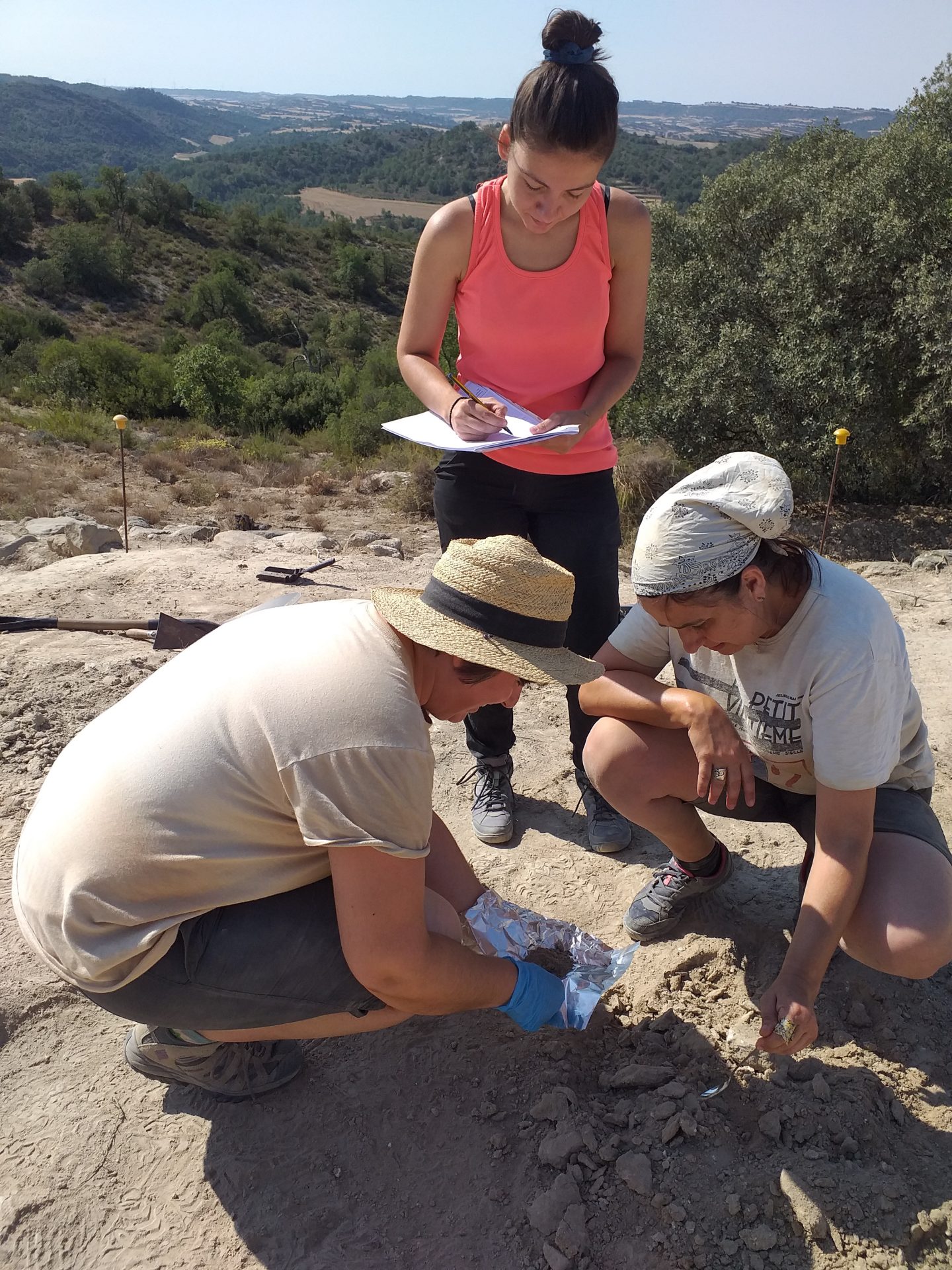
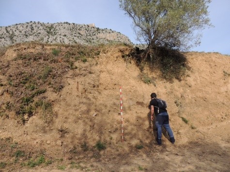
In addition, we conduct archaeomorphological surveys, which involve studying human-made landscape forms such as roads, field systems, terraces, and water channels. Our approach is highly accurate and reliable, using multidisciplinary data to extract information about the historical configuration of cultural landscapes. This information is essential in understanding the economic, social, cultural, and symbolic aspects of the landscape that could not be obtained through other means.
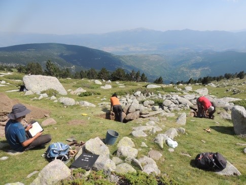
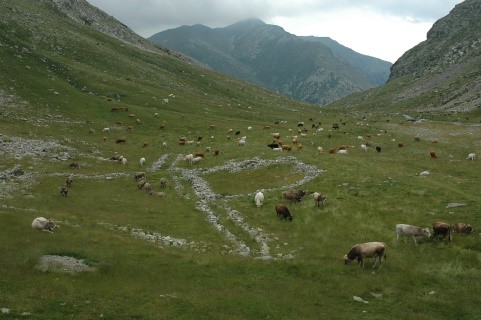
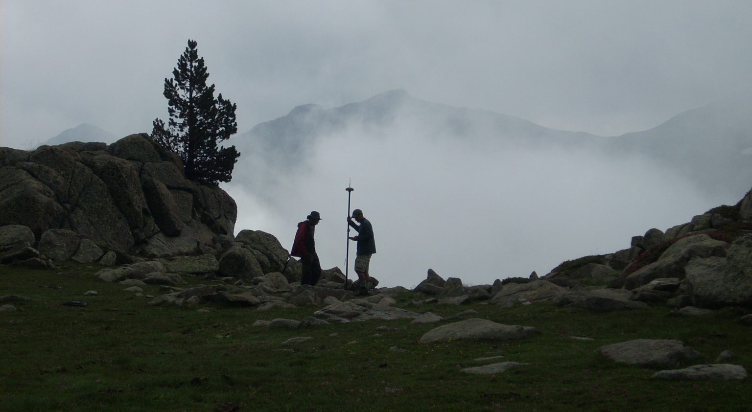
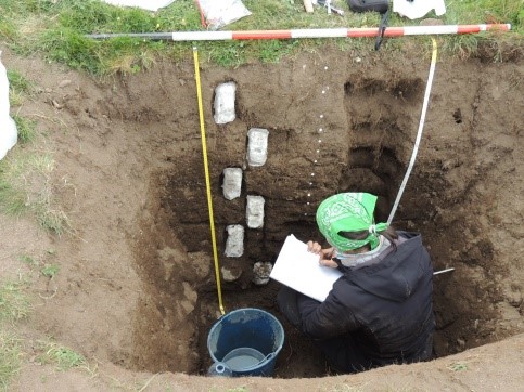
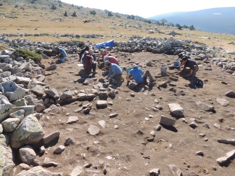
Additionally, we have one of the most experienced European teams working on mountain archaeology, specialising in high mountain areas (above 2000 m.a.s.l.) and our research is highly multidisciplinary. We use a range of methods including photointerpretation, extensive pedestrian survey, test pit excavation, high-resolution multiproxy palaeoenvironmental analyses, archaeozoology, and archaeobotany. By using hundreds of radiocarbon dates, we are able to accurately correlate the excavation and palaeoenvironmental data and investigate long-term human-environment dynamics.
Follow all the news of the cultural landscapes and palaeoenvironment team


